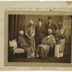
Here is the second instalment on the ‘Elephant in the Room’ in Ethiopia: the country’s environment.
You can read here a first post (with a picture of a leopard taken just 25 km from Addis Ababa!) and read here an account of tracking elephants themselves just 30 km west of Harar. Also, a video interview with Tsegaye Taddesse from Farm Africa, about how community managed forests in Ethiopia are preserving and increasing forest coverage (link to video in today’s Guardian here and link to accompanying article here). Also, about community tourism and forest conservation, a post we wrote here a while back about the new community tourism project in the Rift Valley initiated by ESTA for which Equus Ethiopia gave training: It takes a village?
Everybody, but just everybody, knows where Mount Entoto – also known as the Entoto Hills, or just plain Entoto, is, right? But I’d bet that you don’t! Or rather, that the mountain was moved from beneath your very nose… but how is that possible?! – It all happened in another age of course, when kings reigned supreme and the hills were still young – but more about this later!
We are told that Emperor Menelik first set his sights on the mountain top of Entoto, seeking a more permanent – and central – position for his roving capital. Entoto, easily defendable, at the center of the new trade routes from the Red Sea and strategically placed between the newly conquered west and south and the old Abyssinian north territories, was perfect – as long as there was plentiful wood – soon cut down – and water – which soon ran dry. His consort, Taitu, who was want to soothe her rheumatic feet in the springs of Filwuha, is credited with dragging her husband down the mountain – and christening the new town after the yellow blooms of the Mimosa trees that grew between the springs. True or not, the story provided sturdy roots for an ever vivacious flower – and the tents and bath shacks of Filwuha have bloomed and bloomed to become the 4 million metropolis of Addis Ababa we know today.
But by the beginning of the 20th century, what we now call environmental degradation had taken its toll, and Menelik set about building a new capital, the aptly named Addis Alem – or New World – near the plentiful forests of Ginchi – and had it not been for the import of the Tree-From-Beyond-The-Seas, or Bahar Zaf – the Eucalypt, move the capital would certainly have done.
But today’s Addis Ababa, with its new ring roads and condominiums, still lives in the shadow of the Entotos Hills, and of this heritage of environmental degradation – and the question of what to do with this heritage and how to improve it, has never been more pressing. Look up from anywhere in Addis and you will see mountains – to the north the Entoto chain itself, to the west, Mount Wechacha, to the south Yerer, and, further away, but well visible on a clear day, the volcanic cone of Zuqwala rising above the plains and the Rift Valley. Zuqwala even features on Fra Mauro’s map of the world from 1450! These mountains, with their balmy climate and the safety and wood and water they provided year long, have long made the larger Addis Ababa site sought after – the rock churches of Washa Mikael and Adadi Maryam, the ruins on Mount Yerer and the medieval capital of the Abyssinian kings pointed out in the Zorzi Itineraries, all show conclusively how important the area has been throughout Ethiopian history.
And never has this been truer in today’s Ethiopia and contemporary Addis Ababa, moving forward quickly and confidently it now seems – albeit with a backwards glance at those hills – those disappearing forests! Those drying up springs! That loss of wildlife! Even a flower of cement needs all the water and clean air it can get… The Entoto Hills, the lung of Addis Ababa, is visible from all over the city. And like all visible things, sometimes forgotten and taken for granted. But the Entotos are now the focus of economic and environmental efforts – projects such as the Gulele Botanical Gardens and the Ethiopian Heritage Site seek to replenish the forests with indigenous species and attract visitors. It seems like a new era is dawning for Addis Ababa and its surroundings – a now vibrant city which would use – responsibly – the green hills and magnificent scenery it is crowned with. Entoto can become a ‘brand,’ a city forest that would add to Addis Ababa’s economy in tourist dollars, but also provide environmental security (clean water and clean air) and something intangible called quality of life for the increasing numbers of what is now a big and ever growing city.
Back in the 15th century, the Emperor Zara Yacob forbade all logging in the forests of ‘Menagesha,’ and is said to have brought seedlings to replenish the forest from far away Wof Washa in Ancobar. This makes Menagesha Suba Forest (on the western flancs of Mount Wuchacha) the ‘oldest conservation area in Africa…’ True or not, it certainly makes for a good story of Ethiopian conservation by Ethiopians. And of course, back in those days who is to say what was meant by Menagesha Forest? For all we know, it was probably a name that applied at the time to all of the hills around what we now call Addis Ababa, and which were at the time all covered in the Junipers and Kosso of montane forests teeming with animals.
But back to that old, but more recent – 19th century – Mountain moving episode… What few people know is that Menelik first set up his roving capital not to the north but to the west of what is now Addis Ababa, on Mount Wuchacha, in a place that was then called… Entoto! A few years later, having cut down all the trees, he upped sticks and set up on the hill range to the north. His first act as a king in his new capital? He told everyone he didn’t much fancy changing names and that henceforth the ‘new’ mountain would be also known as Entoto! Which it still is. Today, we can no longer move mountain ranges and their forests at will. All the more reason to take care of those we have.


